food

Neighborhood · City of San Diego neighborhood
UTC mall, the UCSD edge, and the densest job cluster in the county outside downtown.
Population
Median home value
Aug high / Jan low
To downtown
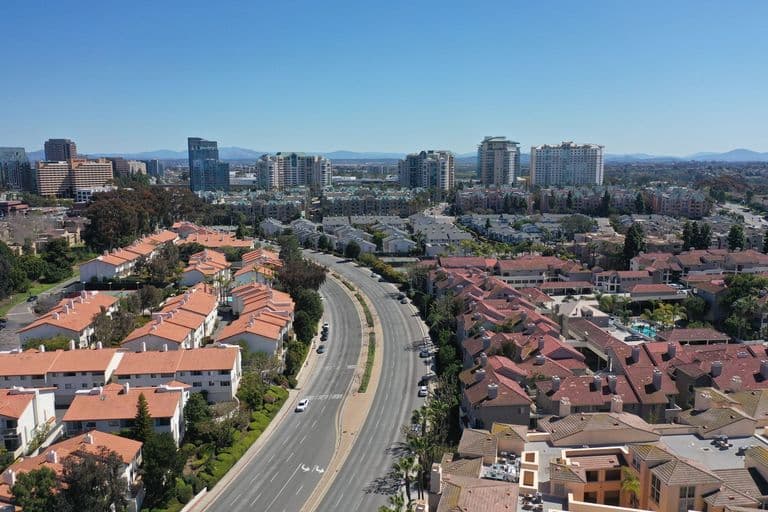
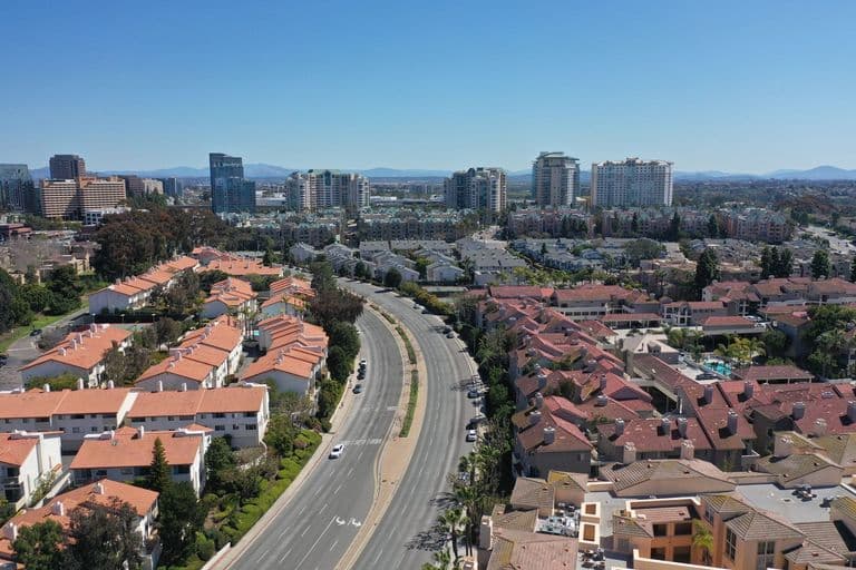
University City is the triangle of mesas and canyons bounded by Interstate 5, Interstate 805 and State Route 52, which is why locals and real estate agents call it the Golden Triangle. It began as a 2,500-acre master-planned community in 1959, intended in part to house faculty and staff at the new UC San Diego campus, which replaced the World War I-era Camp Calvin B. Matthews rifle range in 1964. The community has two distinct halves. South of Rose Canyon, around Governor Drive, are 1960s and 1970s single-family streets, many named for Nobel laureates, with neighborhood schools and Standley and Doyle parks. North of the canyon is one of the county's densest job centers: Westfield UTC, Scripps Memorial and UC San Diego's Jacobs Medical Center, biotech campuses and more than 9.5 million square feet of office space, surrounded by apartment towers and condos. The opening of the UC San Diego Blue Line trolley extension in November 2021 tied UTC to Old Town and downtown by rail and has accelerated high-rise residential construction around the Executive Drive and UTC stations. ZIP 92122 counts about 45,400 residents with a median age under 32, reflecting the student and young-professional population, while the older single-family pockets remain some of the more attainable detached housing this close to La Jolla. Redfin's July 2026 median sale price was about $854,000, a figure pulled down by the area's large condo share.
Draws
Tradeoffs
Good for: UCSD affiliates, biotech and hospital workers, and buyers who want a central North City location with rail access.
University City sits on mesas three to five miles from the coast, close enough for regular marine-layer mornings in May and June and cooler summers than I-15 communities. Afternoons on the eastern side near I-805 run a few degrees warmer than the UCSD campus near the bluffs. Santa Ana wind events in fall can push temperatures into the 90s and raise fire risk along Rose Canyon.
Aug avg high
Jan avg low
Annual rain
Best time to visit: September through November, when the marine layer thins and campus and UTC are fully active.
Typical home value $854,208 (-8.9% year over year)
South UC is mostly 1960s-70s single-story and split-level tract homes on modest lots; north UC around UTC and La Jolla Colony is dominated by condos, townhomes and newer mid- and high-rise apartments near the trolley.
Freeways: I-5, I-805, SR-52
Transit: UC San Diego Blue Line trolley (UTC, Executive Drive and UCSD Health stations), MTS SuperLoop rapid bus, plus MTS and NCTD routes.
Parking: Easy in south UC neighborhoods; paid and limited at UC San Diego and congested at UTC and around Genesee Avenue at peak hours.
Walkability: Mixed: Redfin rates the area somewhat walkable (Walk Score 54) with some transit (49), highest near UTC and the trolley.
It suits people who work at UCSD, the hospitals or the UTC office corridor: it has trolley access, parks and a highly educated population (74.9 percent with bachelor's degrees in ZIP 92122). Tradeoffs include traffic and a large transient student population near campus.
Redfin's July 2026 median sale price was $854,208, down 8.9 percent year over year, reflecting a high share of condos. Detached homes in south UC typically sell well above that, and the ACS 2024 5-year median home value for ZIP 92122 is $1,046,300.
Mild and coastal-influenced, with morning fog in late spring. NWS Miramar normals show January highs near 66°F, August highs near 81°F and about 10.65 inches of rain per year.
UC San Diego, Westfield UTC, the Golden Triangle biotech and office corridor, and Rose Canyon. It is also known for the San Diego California Temple beside I-5.
Yes. Since November 21, 2021, the UC San Diego Blue Line has run from UTC and UCSD through Old Town to downtown and on to San Ysidro.